Simon Ferdinand in Environment and Planning D: Society and Space (2016, online first), 1-20.
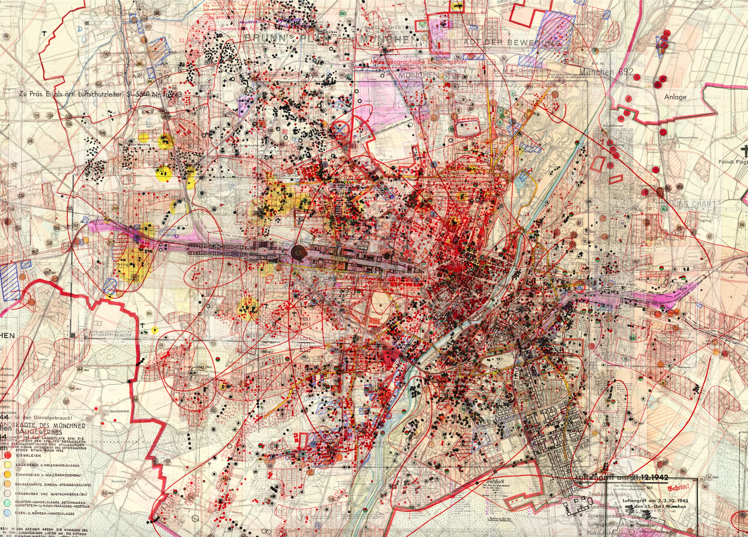
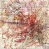
This article attends to the work of Dutch artist Gert Jan Kocken, one of the foremost arts practitioners to have drawn on geographical mapping for formal and thematic substance in recent years. Discussion focuses on his series the Depictions, in which found maps, made in pursuit of conflicting ideologies during the Second World War, are combined digitally into composite representations of cities such as Amsterdam, Berlin and Rome. Layering together hundreds of different cartographies, the artworks provide a concentrated exploration of the connections between maps, states and warfare. To grasp these connections, I read the Depictions in conjunction with Zygmunt Bauman’s conception of the modern state as a “garden” of society and space. In doing so, I highlight Kocken’s vivid demonstrations of not only the transformative potential released in state military mapping but also unevennesses and dialogic complexities with which even apparently totalising state gardening projects are fraught. My study of the Depictions builds an image of modernity as a contested garden; the article concludes by suggesting the commensurability of this vision with the social present.